Tuesday, December 4, 2018

A Five-Year Break

I can hardly believe it, but it has been over five years since I last travelled anywhere. Okay, I have been to Mexico twice (less than a full week in each Baja and Isla Mujeres), but I am starting to work travel back into my life. Many hours of my life recently have been devoted to finding cheap plane tickets, booking impromptu trips to wherever we can find the cheap plane tickets, and researching said places.

It is my hope to be able to come back to this blog with each trip to lay out some details and share a few stories. It's amazing how therapeutic it can feel to spend 10 minutes revisiting stories from my own travels...

So, without further ado, the 2018-2019 line-up so far includes:

Jamaica December 25th to January 1st

Ireland March 23rd to March 31st

Shorter trips than I'm used to, yes. But, the longer trips will come (starting with Myanmar this summer, hopefully!). I am thankful for the time I have to do these trips, though, and I cannot wait to get back out there. 

Picking Up the Pieces and Starting Fresh


Five years after this trip, I revisited this blog because I am (finally) about to start traveling again... And I see that I never finished the Nepal/Annapurna Circuit trip report. Oh well! Below is everything I had typed up in a draft--the rest of the details are either in a travel journal stashed away somewhere, in my brain stashed away somewhere, or gone forever. Regardless, there is one thing I know for sure: This hike in Nepal was one of the most special and memorable things I have ever done in my life.

So, I'll leave these last few pieces of my memories here as I start getting back into blogging because... drum roll please... Jamaica, Ireland, Thailand, and Myanmar, here I come!


Day 17: Bamboo to Macchapucchre Base Camp (MBC) (3,700m); 8.5 hours
This day became an especially long one due to a two-hour rain delay starting around 10:30am. We got to the village of Himalaya just after it started, so we sat down for tea thinking it'd be gone soon. Oh, were we wrong. It rained... And rained... And then rained some more. It even hailed for a few minutes. Trekkers slowly gathered in the restaurant as the hours passed. Finally, when we were tired of being couped up and cold, we decided to go for it. It continued to rain, but lightly so it was manageable.

Day 18: MBC (to Annapurna Base Camp; 4,130m) to Bamboo; 4.5 hours (plus the early morning hike to ABC)


Day 19: Bamboo to Jhinu; 5 hours


Day 20: Jhinu to Kyumi and bus to Pokhara; 3.5 hours walking

Thursday, April 18, 2013

The Hike That Had It All: In and around the Annapurnas (Part VI)

Only ten days done--ten days which seemed in some ways like forever, and in some ways like we had only just begun. BUT, we were only halfway done at this point! Back in Manang, after finding out that our original plan of doing a side-trek to Tilicho Lake wouldn't work, we had made plans with Richard to add on what's referred to as the Sanctuary Hike, or the shorter, easier hike up to Annapurna Base Camp. We had the time and the desire, as we'd heard the views on this hike were also stunning (since you walk right through the middle of the Annapurna Conservation Area). So, that became the plan!

The next ten days were different from the first. I can't really describe how they were different, but I think it's because we completed the hardest, most anticipated part of the trek so now we were a bit more relaxed I suppose. Our days went as follows:

Day 11: Muktinath to Jomsom (2,720m); 19 kilometers, 7.5 hours
This was a long, hot day. We took the upper, longer route in order to go through the village of Kagbeni, a trekker's favorite because of it's medieval feel of narrow alleyways that go under ground and through buildings.

Day 12: Bus from Jomsom to Tatopani (1,200m); 5 hours, 1,200 NPR each
What else can be said about a five-hour bus ride in the middle of the hot day on an old, crowded bus driving downhill on a dusty, winding road, while looking down at the river hundreds of meters below the drop-off that's only inches away from the bus's tires?

Day 13: Rest day in Tatopani (hot springs)
A nice little village worth an extra day. We did laundry. We drank beer. We enjoyed the hot springs.

Day 14: Tatopani to Ghorepani (2,870m); 17 kilometers, 7.5 hours
Another long day, but oh-so-beautiful day. We started seeing some of the rhododendrons that the area is famous for in the spring. We climbed up again that day and had amazing views of the Annapurnas (including Machapuchare, aka "Fishtail") and the villages below and across on other steep hillsides.

Day 15: Ghorepani to Tadapani (and Poon Hill); 4 hours
We woke up extra early to hike Poon Hill for sunrise, which is what it's famous for. Unfortunately, we missed the turn-off in the dark and didn't make sunrise, but got up high enough to have some good views (some guys coming down said the view from the top was no better than where we were at that time so we didn't continue up--I wasn't feeling well). I had gotten sick the day before and was feeling weak from that after Poon Hill, so we went back to bed for a bit and started a few hours later than normal this day. Once we got going all was well and the rhododendrons were out in full force now, with all the surrounding hillsides a shade of red because there were so many flowers. Stunning.

By this day it was very apparent just how crowded these trails were compared to the Circuit. SO many people!

Day 16: Tadapani to Bamboo; 7.5 hours
Because I was feeling healthy and we had an easy day the day before, we went further than planned today. We just kept going... We ran into a guy, on his way down, who we'd met in the first few days of the Circuit hike and he recommended a good place to stay in the village of Bamboo, so we made it there, had a hot shower (that electrocuted me!), and had some decent food.

*Days 17-20 coming soon!

Friday, April 5, 2013

The Hike That Had It All: In and around the Annapurnas (Part V)

DAY EIGHT (Tuesday, March 12th): Manang to Yak Karka (4,050m)
9 kilometers, 4.5 hours
This day marks the part of our hike where our days were dictated more by elevation than how much energy we had to carry on. Given that you shouldn't sleep higher than 300-500 meters higher than the previous night, the hours spent on the trail became much shorter.

This day also marked the day where my notes in my journal became sparse:

"Muddy trails. No avoiding it. More yak. Walking slowly. Stunning views. Feel good as long as go slow. Pot of mint tea after walked to next village in search of safe drinking water (still frozen so no luck). Upstairs afternoon dining was so warm from the sun, all windows, corrugated roof--greenhouse-like. Nice. Dinner downstairs in heated dining room (yak dung stove) with Richard, a German couple and a South African/American couple who had been teachers in Korea. First night of small group where everyone was in one conversation. Talked about the trek, other trekkers, East/West Germany, Korea and Japan. Great night. Dal baht for dinner. In there until 8:45pm. Good times."

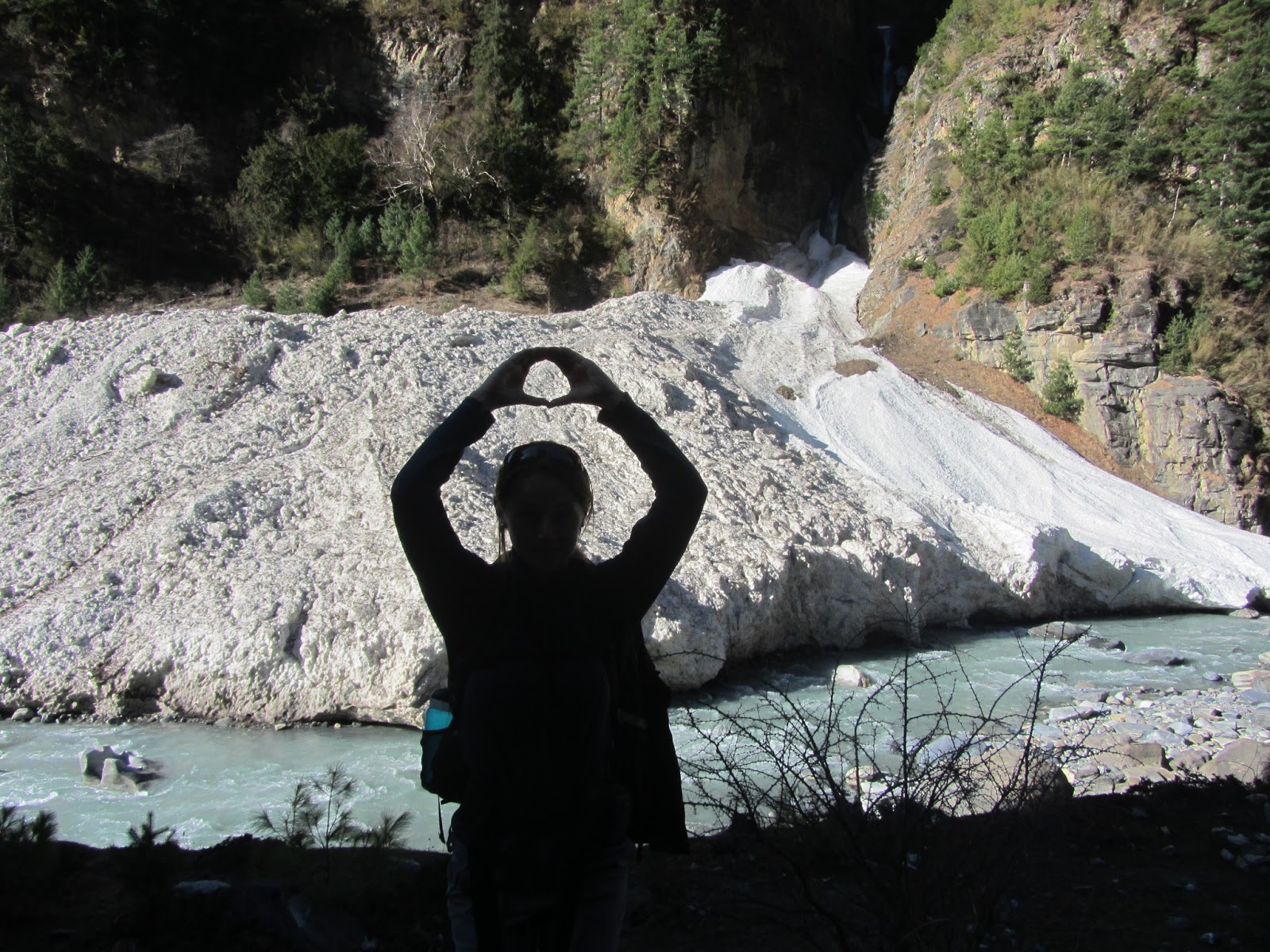
Yes, the trails were extremely muddy and the massive, long-haired and beautiful yak plentiful. I don't remember much about the day's hike, but this evening was one of the most enjoyable we'd had on the entire trek. Like I mentioned above, upon arriving to Yak Karka, we set our packs down and trudged on to the next village (150 meters higher) because there was supposed to be a Safe Drinking Water Station there. Turns out, it was still frozen so yet again, we pushed our bodies a little extra that day in the hopes of rewarding them with water, only to be let down. Again. However, we were constantly rewarded with near perfect weather, interesting sights and beautiful scenery, so really we can't complain.

Since we were again at the mercy of our chlorine pills that took four hours to purify our water, we drank the pot of mint tea in the warm dining room of our lodge. It's amazing how hot the sun is up at high altitude and how much it warms things up during the day.

Most evenings we were in bed by around 7:30pm, reading until we fell asleep (usually close to 8pm), so to be in the dining hall until 8:45pm socializing with the small group of trekkers in our lodge that night was a (welcome) surprise to all of us. You could sense the excitement and anticipation among us, as it was our second to last night before crossing... DUH DUH DUH... THE PASS.

DAY NINE (Wednesday, March 13th): Yak Karka to Thorong Pedi (4,450m)
6 kilometers, 3.5 hours

From my journal:
"Short day. Started very slowly, but once warmed up took it slow and steady and felt good. Landslide area. A few small-ish rocks fell in front and behind me. Mostly even or gradual trail. Last bit of trail narrow in snow. Lots of places on the trail today where it was narrow and very steep below."

By this time, it was pretty apparent that our energy had been zapped quite a bit from the altitude and many days on the trail. We knew we were crossing a landslide area where there were known to be falling rocks, so we spread ourselves out by about 10-20 meters and kept aware. Luckily, the one time rocks did start falling down within feet of me and my head, I was directly in front of a boulder large enough to hug with my body for protection. The first rock that fell sounded much bigger than it probably was (maybe the size of my two fists put together--certainly large enough to cause damage), the second two quite small. Scary nonetheless and shook me up a little as I had Tobias function as my eyes as I crossed back to safety.

This was our final night before the big day that everybody on this trek anticipates with a combination of nervousness and excitement. We had a great room that our friend Richard had gotten for us, as he arrived earlier than we did. It was a corner room, in the highest building of our lodge--which was the highest lodge in the village (there are only four). We had huge windows on two walls and got direct afternoon sunlight. We couldn't believe it, we were warm enough sitting in our room without huddling in our down jackets, sleeping bags, and 14 other layers. Amazing.

DAY TEN (Thursday, March 14th): Thorong Pedi to Muktinath (3,800m)
16 kilometers, 10 hours

From my journal (with a little help from Tobes):
"WE DID IT! Hardest hike ever. SO, we indulged ourselves in the following upon arrival to Muktinath: mushroom pizza, margarita pizza, Israeli salad, bean/veg/cheese burrito, mojitos and a few local beers. AND, we could have eaten more. Everyone at the table (two Austrian guys, two Russian guys and Richard---all of whom were our friends by this point in the trek), kept getting more and more food. I guess that's what a day like this calls for.

Woke up at 3:40am. Breakfast at 4am. On the trail just after 5am. At the pass by 10am. To Muktinath aroun d 3pm.

Surprisingly, no signs of AMS. But awful headache on the way down as I trudged through the snow on steep downhill slopes. Scary.

Way up: Began in the dark, so slowly step-by-step our way up a steep hillside toward High Camp, the last stop before the pass. Could see a line of headlamps above and below. To High Camp before 6:30am. Beautiful. Can't describe in words or stress it enough. Strange little pheasants or grouse up there digging around in the snow.

Maybe it's because everything I've read has hyped up the pass as being so difficult, or because I still wasn't certain (or confident) of how my body would deal with the altitude, but I didn't actually think the hike up was as hard as other parts of the hike. Though, the lack of oxygen was certainly felt and frequent rest stops were needed (especially by me). Maybe it just seemed shorter because I'd blown it up in my head, or maybe because we were just so excited about the whole thing.

Getting to the top was a great feeling, with people congratulating each other, hugging and high-fiving. All smiles up there.

The sign, normally about 2 meters high, was buried in snow (apparently a record high for this time of year).

We took our photos, a few group photos, ate a Snickers bar each, stood around in awe of ourselves and our surroundings, then came down off our high knowing we still had a long day ahead to Muktinath.

The way down was rough. Snow and ice, slippery as it melted under the intense sun at over 17,000 feet. No poles to help us along, like most other trekkers had. Falling on my ass more times than I want to remember (8? 10?). Headache started pounding. Not sure if AMS, migraine, dehydration, cold, sun, or what. Pounding. Throbbing. Falling.

Took until almost at Muktinath to get any easier. Crazy. BUT, we decided we'd 100% do it all over again. Snow on us (again!) for the last hour or so to Muktinath, but our spirits were once again high as we were mostly on level ground. Arrive to hotel to find some trekking friends (Austrian guys, Russian guys and Richard) already there and everyone was happy after such a feat.

I still don't think I've fully comprehended what we've just done in the past ten days..."

There's so much more to say about this day, but I wouldn't know where to start. It was long. It was both exhilarating and exhausting. It was calming (staring out at the views from so high up) and tense (staring down at the steep slopes of snow and ice below, where one mis-step on the narrow trail could have been trouble). It was emotional--both at the top and on the way up and down. A wave of emotion definitely came upon me when we reached the top, somewhat familiar to emotions I've felt before after winning a big game or race. On the way up, there were a few times where I just couldn't go any more, I had to stop, catch my breath and take a rest. I couldn't move. But those never lasted long and after a few minutes and a few drinks of water, we carried on. The way down brought out the worst emotions in me--frustration, anger and wanting to just give up. At first, falling in the snow was all fun and games. I laughed each time I gave into the snow and fell--there was even one part that we just sat down and slid down on our back sides like little kids. But after a while, after what seemed like hours of steep downhill where you had to focus intently on each and every step, falling lost its glamour to me. Then I just became angry and frustrated from the pain of the downhill, my throbbing headache and the fact that I couldn't keep myself from falling. But, after the headache went away and we came closer to the end of the day's hike, spirits were once again high--despite the looming bad weather.

From the pass we could see ahead a collection of dark grey clouds hovering over what we knew to be our final destination for the day. So, once up and over the pass--which until the way down had been nothing but sunny and clear blue skies, it was all grey, cold and windy from there. Luckily, by the time it started snowing on us we were in good spirits, so it didn't matter much.

We also had our first warm shower in what seemed like days--since Chame on day four, to be exact. The water itself was hot, but the shower stream was minimal and the broken window that let in the freezing air to the bathroom made for a mildly uncomfortable experience. But, alas, we were (relatively) clean and were able to dry our shoes and hair out by the electric heater in the dining hall.

Thursday, April 4, 2013

The Hike That Had It All: In and around the Annapurnas (Part IV)

DAY SIX (Sunday, March 10th): Upper Pisang to Manang (3,540m)
19.5 kilometers, 8 hours
This day was going to be our longest day yet, but we had the incentive of a rest day the following day to keep us going. It was another apple porridge and tea breakfast before leaving our lodge just before 8am with Yolanda, our young and admirable German friend.

We started the day's hike by climbing up 420 meters to the next village of Ghyaru (3,730m), following endless switchbacks that were originally created for the crew who installed the electrical poles going up the side of the mountain. Given the ever-increasing elevation gain, and the fact that our bodies were in desperate need for some rest after five days straight of trekking, it was slow going (yet steady) going up those 420 meters. Many of us who had stayed in Upper Pisang the night before set out within about 20 minutes of each other so we made for quite a sight, I'm sure, dotting the hillside from bottom to top.

Once we got to higher altitude (i.e., starting this day and on every day here forth), there was only one way to get up steep climbs like this and that was to keep your head down, your breath under control and take slow, but rhythmic, steps. Left... Right... Left... Right... This morning hike was no exception. Stopping made you lose your momentum and it was that much harder to continue going up, so we rarely stopped but instead just kept a slow and steady pace. Up... Up... Up

At the top, around 9:45am, we were rewarded with what would have been a stunning view of the Annapurnas in front of us and the river and villages below us, but it happened to be the ONE cloudy day we had on the entire trek. I had read countless people talk about just how amazing the views were on this particular day of the trek, but all of us that day instead just got to see clouds. Bummer.

We climbed up and down to the next village, Ngawal (3,680m), and had another lunch of fried noodles. The last stretch of the day was about a three hour hike to Manang, Turns out we took the long way (we could have followed a shorter, alternative route), but it ended up being just as well. It started snowing lightly on us midway through the afternoon's trek and was quite peaceful and beautiful, really.

We lost Yolanda not long after, as she was heading to the school to do a few months of volunteer work, so we said our goodbyes under the falling snow and continued on our way.

By the time we got to Bhraga (3,450m), the snow had picked up a lot and was getting to be very heavy, sticking to everything--including us. The last 30-45 minutes of our day's hike we were walking with our sunglasses on and heads down trying to avoid the horizontally falling snowflakes. Finally, we arrived to Manang, covered in white, and found our friend Richard at Tilicho Hotel. We got a little purple cottage of our own--perfect!

First up, as always, was get into warm, dry clothes! Second up, was a pot of warm masala tea and some fresh Tibetan bread to celebrate our arrival and fill our empty bellies. Finally, some much-needed R&R for 36 hours...

DAY SEVEN (Monday, March 11th): Manang rest day
If ever there was a day that we were tired, it was this day. Our bodies resisted us trying to move them very far, our noses wouldn't stop forcing us to reach for a new tissue every five minutes, and my sinuses created incredible pain and pressure in my face and head. We ventured out to a 500-year old Monastary back in the town of Bhraga, but that took it out of us and the rest of the day became quiet and lazy. We spent the day reading, lying down, eating (baked goods!) and trying to recoop. We had tea with a nice Austrian guy, Chris and chatted mostly about travel through Asia and the trek. A pharmacist and doctor both reassured me that my sinus infection wouldn't be a problem in continuing up in the coming days. We stocked up on a new roll of toilet paper and filled up on water. And that pretty much sums up our day!


Wednesday, April 3, 2013

The Hike That Had It All: In and around the Annapurnas (Part III)

DAY FOUR (Friday March 8th): Bagarchap to Chame (2,710m)
14 kilometers, 5 hours
After my SteriPEN stopped working (first on day two, only to tease us briefly on day three before permanent failure by this day), we mostly relied upon the Safe Drinking Water Stations placed along the trail in various villages. There were a few times during the circuit where we had no choice but to use my chlorine pills, but otherwise these stations were our pot of gold at the end of the rainbow--that we planned ahead for and looked forward to every day. The stations were operated by the community and all the money collected for the water (we paid 40-60 rupees per liter, about US$0.50 or more) went back into the community through local women's organizations, often "Mother's Groups." I'm not exactly sure of the process by which they purified the water, other than that it was ozonated (and never made us sick).

So, on this lovely morning we stopped 40 minutes into the trek at the next village of Danaque to fill up at one of the stations. A few hours later we arrived to the village of Tamang, probably one of the most picturesque villages on the trek. We decided to stop for a little water break to enjoy the views--but so had many other trekkers so we didn't stay long before continuing on a little up the trail to take our snack break away from all the other trekkers (though, not without the cows). We stopped in a field and ate a granola bar while we just stared at all the mountains around us. Magical.

We got to a police checkpoint in Koto just before noon, handed over our permits and had a brief chat about the trail. Anytime you pass a police or ACAP (Annapurna Conservation Area) check-point, it's mandatory that you check in and answer a few questions about where you've been and where you're going while they record all your information into big notebooks (sometimes a computer).

We got to the day's end point, Chame, before 1pm. We had planned to stop here so we'd have time to shower and do a little laundry--with enough sunlight hours in the afternoon to dry our hair and clothes before the cool air of the evening set in. We chose a lodge at the far end of the village, just across a long suspension bridge over that beautiful turquoise river I've mentioned a few times already.

The trail on this day was quite different from the previous few days of bamboo and dry, dusty trails and roads. A lot of the trail on this day was through pine forests full of moss-covered trees and rocks--a lot like Oregon, actually! This was also the first day that we felt entirely surrounded by huge mountains on all sides at all times. It was stunning and there are no words to describe what we could see... The clouds always crept in during most afternoons and covered the mountains up, but we'd usually be given the gift of clear skies come the mornings and evenings.

We had a nice relaxing afternoon and evening in Chame. We ended up having dinner with an American, Richard (58 years old from Southern California) and Yolanda (18, German), two solo trekkers who had met a few days prior on the trail and been trekking together. They are both incredibly independent, but I imagine it's nice to have some company on the trail--especially someone else there in case anything happened along the way. We had assumed they were a father-daughter duo. We ended up spending the next handful of days together off and on with both of them before Yolanda took her leave to volunteer as a teacher in a small village Tibetan school before Manang. Richard was in our company quite a lot until we got a few days into the sanctuary hike in our last week.

It started getting cooler in the mornings and evenings, but still quite sunny and hot during the daytime hours... We went to bed early, as usual, as we had a big day ahead tomorrow going to a village over 3,000 meters.

DAY FIVE (Saturday March 9th): Chame to Upper Pisang (3,300)
14.5 kilometers, 6 hours
We decided on this day to start taking things a bit slower. The previous four days were still low enough elevation that altitude wasn't an issue, and we had the energy to push ourselves a bit (due to our excitement, I think). We made ourselves walk a bit slower and take a few more breaks (though short), and it felt nice.

We left at our usual 7:40am departure time. We walked for quite awhile along a road that paralleled the canyon with the roaring turquoise river below and the mountains above. Despite being on a dirt road and not a real trail, the views were still stunning. We also came across our first glacier on the trek.


(Can't seem to rotate this photo, sorry!)


A few hours later we reached the town of Bhratang, famous for apples. Richard and Yolanda were there waiting for the apple pancakes they'd ordered (Yolanda's German guidebook said they were worth the stop), so we joined them and ordered some apple tea for ourselves.

After we ate lunch with Yolanda in the last village before Upper Pisang, we had only a fairly easy walk for just over an hour left. The trail was mostly flat, going through a vast open area with the river on one side and mountains surrounding us--including Annapurna II in all her glory. The land was dotted with pine trees that had the long needles of a ponderosa pine, but were much smaller trees.

At one point when we were up on a mountain side again walking along a dirt trail, I had seen a flash of tan-colored animal run down the mountain side quite a ways ahead of us. I thought they were moving too fast for any goats or cows, and hadn't seen any horses, but had (naively) assumed it was one of those three animals. About five minutes later we suddenly heard a commotion behind us, and looked back just in time to see a herd of bighorn sheep run up the mountain and stop on the trail about 20 meters behind us on the trail. I was able to snap a few photos, though they're  not great quality. They were incredible, with their--well, big horns! :-P

The reasons we chose Upper rather than Lower Pisang were because the views were supposed to be amazing up there (and on the route that continued from there on the next day), and because it was at a higher elevation and was supposed to help one acclimatize better.

Being at over 3,000 meters on this day, the thinner oxygen was definitely more noticeable. The shortness of breath while hiking came quicker and easier, though we still felt good. We had a nice little lodge on this night, with paper thin walls (typical of tea lodges on the trek) and a stunning view of Lower Pisang and the river below, and all the mountains across the river and above.

There was supposed to be some safe drinking water down in Lower Pisang so once we got settled, we went straight down about 50-100 meters to Lower Pisang in search of water. Turns out, there was no water in the area at all, so we were not only stuck without drinking water for the next four hours, but also had the long, steep climb back UP those 50-100 meters with thinned out air. It left us a little disheartened, yet again.

The village of Upper Pisang was fascinating--it looked like a little medieval stone village on the mountainside, every house and structure made of stone, making the entire village take on the same shades as each other and the mountain in which it rested upon. We saw few inhabitants, despite there being an unusually large number of houses, and most of them were old women. It was quiet and a bit eerie walking around, but amazing nonetheless. We saw one of the dozens of prayer wheel walls here (we were always passing them on the trail), where you'd always walk in a clockwise direction spinning the wheels as you go by. Up at the very top of the village was a temple, which we were let into by a monk in full garb. Most of the trekkers could be found here throughout the rest of the daylight hours, as the views were stunning. This was definitely one of my favorite villages along the trek--minus the water mishap.

Mule train on the road across the way from the trail


Upper Pisang Mani wall

View on the way to Upper Pisang

Temple in Upper Pisang

View from the temple in Upper Pisang

Monday, April 1, 2013

The Hike That Had It All: In and around the Annapurnas (Part II)

DAY THREE (Thursday, March 7th): Jagat to Bagarchap(2,160m)
17 kilometers, 7.5 hours
Our backpacks were by no means the biggest ones we saw on the trail, but it certainly took a few days for our bodies to get used to carrying the weight--especially in the hot sunshine that was beating down on us every day thus far. The day before was rough--probably one of the toughest days we had on the entire hike given the heat and our dehydration. But, day three was a new day and we started it in the usual fashion with our pre-ordered breakfast (this time of chapati, veggie omeletes and masala tea). We got on the trail around the usual time, 7:40am.

This day was also not without scorching heat. We joked about how much we wanted the cooler, higher altitude air, knowing full well that as soon as we got just that, we'd be back to wishing for the warm sun to bear down on us.

About an hour into the day's hike, we got to the village of Chamje, a very cute little village right on the river that, had we known, we might have planned ahead to stay there. Oh well, next time!

We had one hell of a climb up for about two hours before arriving to a good place for lunch--a climb made worthwhile by some crazy monkeys up in the trees above us. The restaurant where we stopped for lunch was the last of three on the long road heading up (some of the trail is actually just on local dirt roads) so we were starved. It was a tiny place on the side of the road help up on stilts and looming over the steep cliffs that go right down into the turquoise river below.

It didn't take long for our eating to become habitual; porridge and tea for breakfast and a plate of fried noodles, fried rice or fried macaroni for lunch. By day three our bodies were noticeably getting hungrier and hungrier for carbs. We ordered two plates of fried rice from the woman who ran this little restaurant and she brought out the biggest plates of rice we had ever seen. We devoured them. And just as I was struggling to finish the last bites, she brought out extra and piled it onto Toby's plate. It was perfect.

We still had a ways to go on this day, but the steadily inclining dry and dusty road wasn't too bad compared to what we'd already faced.The map of Around Annapurna that we had bought for the trek had all sorts of little amusing details on it, so on this day we successfully passed the "Steep stone trail," "Long hot climb" and "Marijuana fields" before arriving to our final destination of the day, Bagarchap. I guess it makes sense, then, that Tobes was offered hashish by an old woman who walked by us on the road sometime that afternoon...

The two French couples ended up in the same lodge as us again on this night, so that made for a friendly hello seeing them again. The lodge that drew us in on this night was completely vacated (as was the entire village, aside from one other group of trekkers up the way a bit), aside from a little old lady sitting out front. We negotiated our 100 rupee price with her, promising to eat in their lodge (which is how you can get the very cheap and free rooms for the night). And WOW, did we make the right choice. For dinner, we ordered pumpkin curry and Tibetan bread, one of our favorite meals of the entire trek. After seeing pumpkins lining the roof I was sold (I LOVE pumpkin). It was a cross between what I'd consider a "curry" and a pumpkin soup, but whatever it actually was, we were in heaven. The little old lady came out at the end of our meal, seemingly seeking our approval (since she WAS the cook, after all). We made sure to let her know just how happy she had made us that evening. What a treat!

This was the first time we caught sight of Annapurna I, when the last of the evening sunshine hit it just right and made it glow behind everything else that had been lost to dusk a while before.